New SE FireMap Tool Unveiled from USDA NRCS
The U.S. Department of Agriculture's Natural Resources Conservation Service (NRCS) unveiled the new SE FireMap, a fire mapping tool for the Southeastern United States that enables resource managers to improve their regional or local approaches to managing wildfire risk and fire management needs through targeted prescribed burns and training. Fire management helps improve forest ecosystem health, increases timber values, reduces the risk of wildfire damage to life and property, reduces ticks and other pests, protects drinking water, and renews healthy ecosystems supporting wildlife habitat, especially in fire-dependent longleaf pine forests.
The SE FireMap version 1.0 decision support tool will map all detectable fires, including managed prescribed burns and wildfires, across nine states. The map and associated tools aim to improve fire management in urban and rural communities through remote sensing and will track both prescribed fire and wildfires throughout Virginia, North Carolina, South Carolina, Georgia, Florida, Alabama, Mississippi, Louisiana and Texas.
“Through partnerships, longleaf forest conservation and restoration have progressed significantly in recent years,” said Terry Cosby, acting Chief for USDA’s Natural Resources Conservation Service (NRCS). “From reducing the risk of dangerous wildfires to improving fire planning for community preparedness or supporting landscape resiliency during impacts from climate change, NRCS’s partnership with the U.S. Endowment for Forestry and Communities has helped deliver an invaluable conservation tool that complements existing efforts to reverse the decline of longleaf forests.”
This work was funded by a NRCS Working Lands for Wildlife partnership agreement with the U.S. Endowment for Forestry and Communities (Endowment). The Endowment led a regional consortium of partners to manage the project and partnered with The Longleaf Alliance to establish the project’s technical oversight team. Team members were provided by the Longleaf Partnership Council and Southeast Regional Partnership for Planning and Sustainability (SERPPAS). After a public proposals request, Tall Timbers was selected to conduct a scoping phase resulting in the release of the SE FireMap version 1.0.
Tall Timbers partnered with the U.S. Geological Survey and used their Landsat Burned Area products to map burned areas longleaf in the southeast from 1994 – 2019. This is especially impressive as nearly 80% of the southeastern U.S. is in private ownership and this represents the first regional effort to map fires greater than 2.5 acres across the region, regardless of ownership. The Longleaf Alliance served in a critical liaison role between NRCS Working Lands for Wildlife and its partners to keep the project on track and well facilitated.
“Once again, NRCS is convening partners to break new ground by spear-heading development of the first large-scale, proof of concept, spatial database to track prescribed burns and wildfire,” said Peter Stangel, Chief Operating Officer at the Endowment. “This tool will be valuable for planning and on-the-ground implementation of prescribed burns, which are essential for forest health, wildlife, and for reducing catastrophic wildfires. The SE FireMap will improve cross-sector coordination and save money. This tool couldn’t come at a better time for land managers who are grappling with the forest health challenges posed by climate change.”
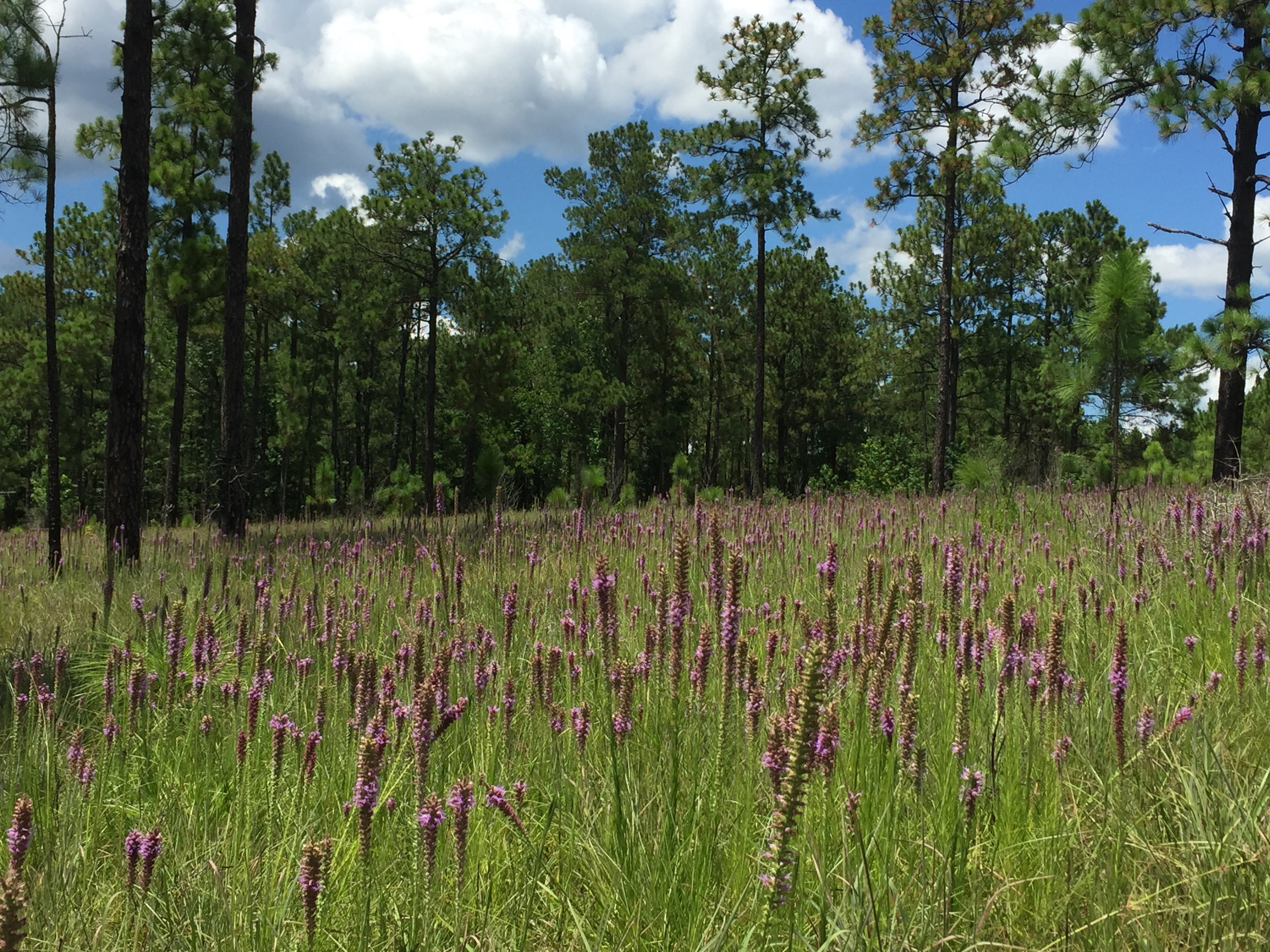
Longleaf Forests and Fire
Native longleaf pine ecosystems thrive with frequent fires and replicating natural fire conditions helps maintain these unique ecosystems and the wildlife that depends on them. Prescribed burns strategically mimic natural fires, which create and maintain open understory to benefit wildlife, including keystone species such as the gopher tortoise and red-cockaded woodpecker, and benefit pine stand health. Restoring longleaf forest ecosystem will support the reduction of regulatory burdens on agricultural producers through species recovery.
Assistance for Forest Management
In addition to projects like this one, NRCS offers technical and financial assistance to help landowners improve forest health. NRCS efforts like Working Lands for Wildlife and the Longleaf Pine Initiative fund improving longleaf forest health. Interested landowners should contact a local USDA Service Center for longleaf pine or wildlife habitat restoration to manage their land for healthy wildlife habitat and longleaf pine ecosystems.
The SE FireMap version 1.0 is a beta decision support tool presented as a Google Earth Engine product available for conservation and community planning purposes. To see the mapping products or request data sharing, go to our partnerships’ Wildland Fire portal Wildland Fire (landscapepartnership.org). New users will be required to register on the portal to access the web map.
A free informational webinar, hosted by the Southern Fire Exchange, will be held on April 16, 2021, at 1:00pm ET: https://ufl.zoom.us/webinar/register/WN_LSmIiGrISXmo1faK0iT3gw
For more information about the SE FireMap:
- SE FireMap Homepage
- SE FireMap V.1 Beta Product Information
- SE FireMap V.1 Beta User Guide
- SE FireMap V.1 Data Use Agreement
- SE FireMap Resource Library
Archive
- February 1
- March 1
- February 1
- March 1
- May 1
- June 1
- July 2
- August 1
- October 1
- November 1
- December 1
- January 3
- February 2
- March 1
- June 1
- August 2
- May 1
- October 1
- November 1
- January 2
- February 1
- April 2
- June 3
- July 3
- August 3
- March 2
- October 1
- November 1
- August 4
- September 3
- November 2
- December 2
- June 2
- May 1
- April 2
- March 2
- February 1
- January 2
- January 1
- March 1
- May 2
- June 2
- August 1
- September 1
- November 1
- December 2
- January 1
- March 1
- May 2
- June 3
- July 1
- August 1
- September 1
- October 1
- November 2
- January 2
- February 1
- April 2
- June 1
- July 2
- August 2
- November 3
- December 3
- February 3
- April 2
- May 2
- June 1
- July 2
- August 2
- September 1
- October 2
- November 2
- December 1
- January 2
- February 2
- April 1
- May 1
- June 1
- July 4
- August 1
- September 1
- October 2
- November 2
- February 1
- May 2
- March 1
- June 3
- January 1
- July 1
- August 1
- October 1
- November 1
- April 3
- May 1
- June 3
- August 1
- September 2
- October 1
- December 2
- December 1